Activity: Laetoli Footprints Topographic Puzzle
The now-defunct ENSI website had a great pdf to scale of the 3.6 million year-old footprints found at Laetoli, Tanzania, possibly the earliest evidence of bipedalism for Australopithecus afarensis. Year after year, this is a popular introductory activity for my high school students. Fresh from the Great Fossil Find, they spontaneously try out different ways to analyze the topographic maps.
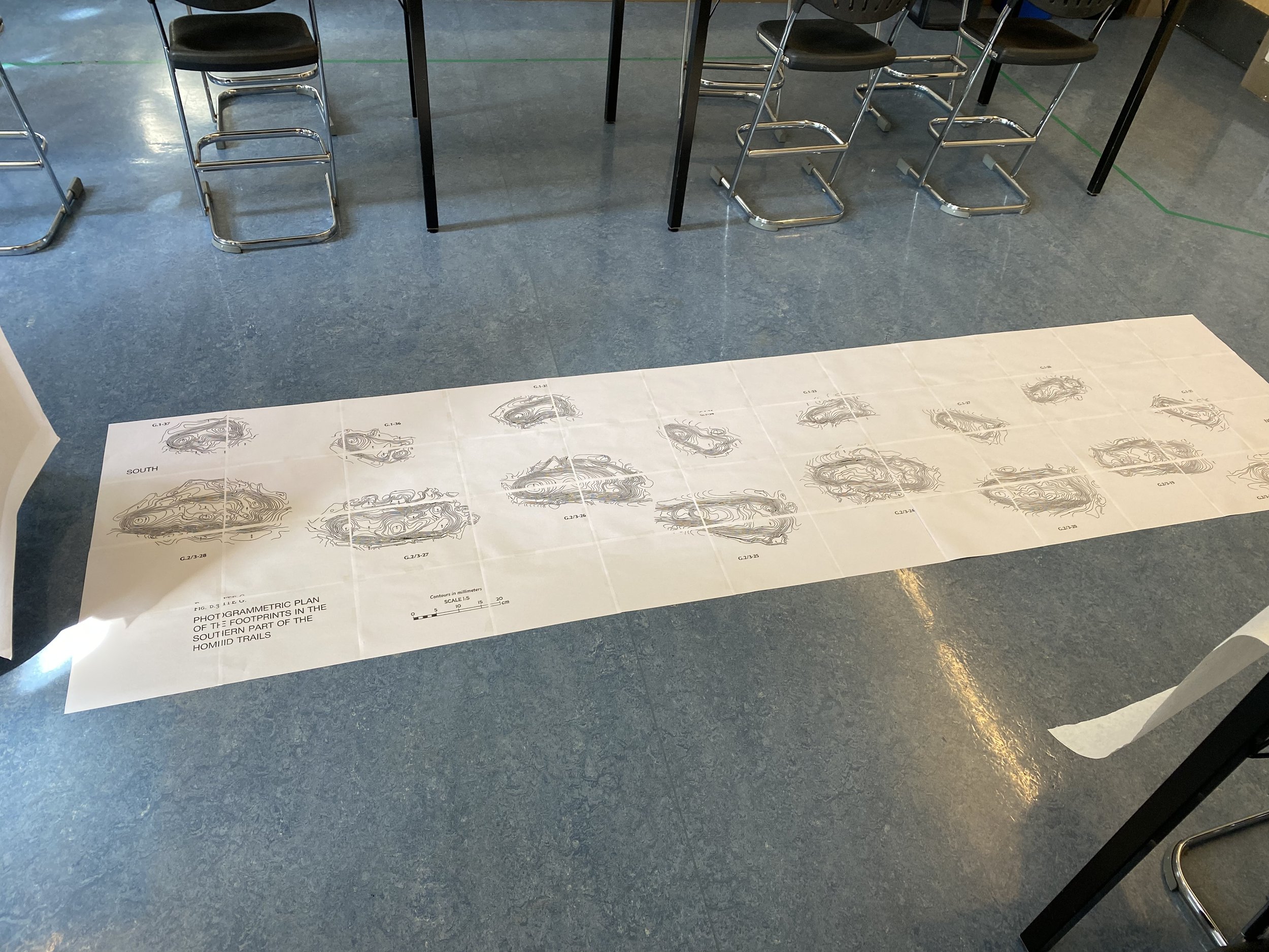
click here to download them for yourself. Many other updated maps, lesson plans, and worksheets, including HHMI Biointeractive’s graphics, are available for this activity online, but I have yet to find one that lets you print out on 8x11s.
When I did this years ago, I think I clipped some of the edges. Results may vary. (“It’s only a model.” - Monty Python) It takes about 20-minutes for someone with sciatica to tape together on the floor. I recommend laminating them before taping them together.
Students will take off their shoes to walk on them and experiment with different gaits and pairings of heights. If the ground is wet outside or there is sand, they will ask to try it outdoors. Wrap their feet in plastic bags and require they film it and photograph the imprint with a scale reference looking from the top-down.
Suh-ggested Warm Up: Have them graph the class left foot lengths and heights using sticker dots on poster graph paper.
I cannot yet find the original large-res pdf in my folders but when I do, I will link it here, too.